
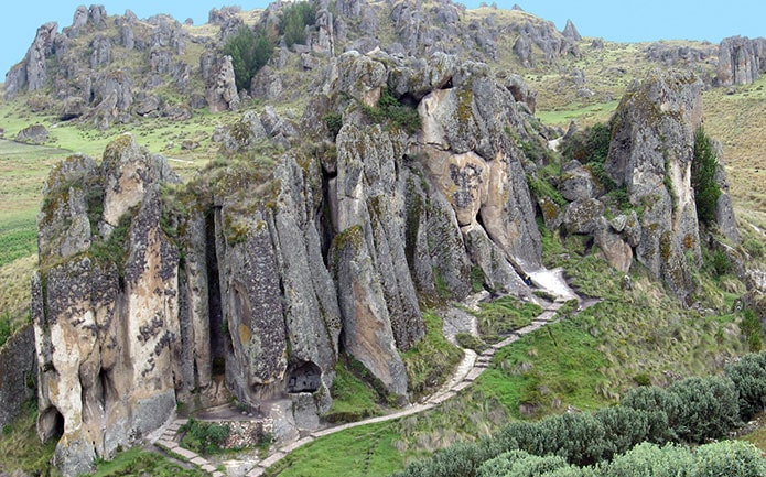
Cumbemayo is located 20 km west of the city of Cajamarca, at 3,500 m (11,480 ft) above sea level.
Its name is usually explained as coming from Cumbe, “fine”, and Mayo, “river”, meaning “fine river” in Quechua.
The canal was found in 1937 by Ernesto Puente, administrator of the San Cristóbal estate (Chilango valley, near Magdalena), who, while clearing his land, discovered a channel carved into the rock, along with large stones and walls with petroglyphs.
During the Archaeological Expedition to the Marañón in 1937, Dr. Julio C. Tello briefly described his partial visits to the aqueduct. The most thorough study was carried out in 1947 by George Petersen, whose results were published in 1967.
This aqueduct belongs to the Formative period. Its purpose was to supply water to Cajamarca, collecting the water that runs down from the Majona, Yanacagua, Concejo, Frailones and Cumbe hills and carrying it to a large reservoir from which it was distributed.
According to Tello, Cajamarca drew its water from two large pools west of the city, on land that now belongs to the San Ramón school, fed by the Cumbemayo canal. If so, these pools would have supplied the fountains that existed in 1532 in the courtyards of the Inca lodgings described by the Spanish chroniclers.
There are some differences over its exact length: Petersen gives 9 km and Ravines 7.6 km.
SECTIONS
Western side of the Andes: Section 1
First stretch: carved in rock: 850 m
Second stretch: built along the hillside: 2,600 m
Total between the intake and the pass: 3,450 m
Eastern side of the Andes: Section 2
Third stretch: from the pass to the Cajamarca reservoir: 5,650 m
Total length: 9,100 m
FIRST STRETCH: 850 meters long, beginning at the intake at about 3,513 m above sea level. It is carved into whitish volcanic rock and measures 35 to 50 cm wide and 30 to 65 cm deep. To slow down the flow of the water, some parts zigzag.
SECOND STRETCH: 2,600 meters long, from the end of the rock-cut channel to the pass on the continental divide, at about 3,350 m above sea level.
THIRD STRETCH: 5,650 meters long, from the pass down the San Vicente ravine, via Relingo, to the place called Agua Tapada, where a rock-cut channel crosses the old mule track between Cumbe and Cajamarca. It then runs along a ravine to a reservoir at the foot of Santa Apolonia hill.
Advertisement


