
According to oral tradition, the countryside of Arequipa so impressed the Inca Mayta Cápac that, wanting to give his troops a rest, he exclaimed “Ari, quepay”: “Yes, stay.” From Cusco he later arranged its settlement, sending 3,000 families who established villages throughout the valley.
After Diego de Almagro returned from his failed expedition to Chile (1537), Captain Garcí Manuel de Carbajal, on behalf of Francisco Pizarro, founded a Spanish city on August 15, 1540, with the name Villa Hermosa de Arequipa. It was founded with 51 residents.
According to the historian Ladislao Cabrera Valdez (1924), the first Spaniard to reach Arequipa was a fugitive, the soldier Pedro Calvo Barrientos, known as “El Desorejado” (“the earless one”) because his ears had been cut off as punishment for stealing gold and silver from the leaders of the conquest in Jauja. The city received its coat of arms by royal decree on October 7, 1541.
THE CITY OF SILLAR
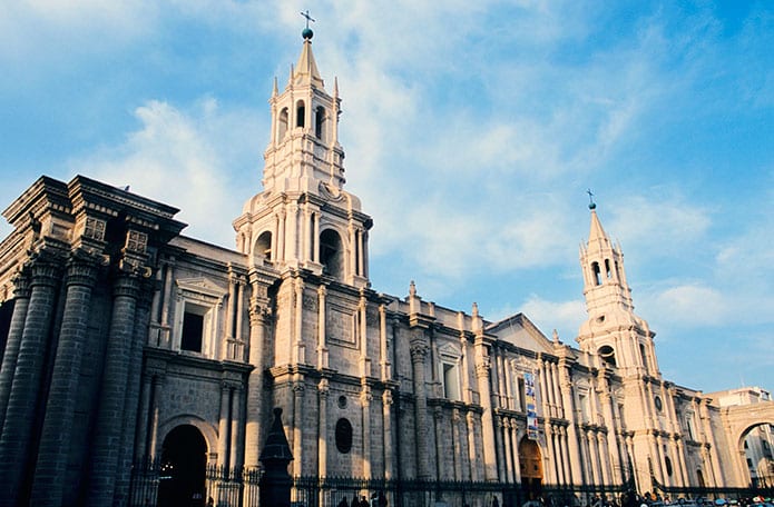
The use of sillar, a white volcanic stone, became widespread with the building of the church of La Compañía de Jesús, begun in 1595 and completed in 1698.
The quarries are near the Misti and Chachani volcanoes. Sillar ranges in color from bright white to ash gray, with snow-white the most prized. It is volcanic ash hardened over thousands of years, rich in feldspar and glassy minerals, which makes it ideal for fine carving. It also bonds well when the blocks are joined with lime and sand mortar.
In religious architecture, sillar’s ease of carving allowed artistic façades, vaults, capitals, columns, domes and arcades, giving rise in the 17th and 18th centuries to a unique local version of the “Mestizo Baroque” or “Andean Baroque”.
In recent decades the use of sillar in new buildings has declined, as thick sillar walls are less practical for modern construction.
GENERAL INFORMATION
Region established: April 26, 1822.
Area: 63,527.62 km²
Capital: the city of Arequipa.
Population: about 1.4 million.
Provinces (8): Arequipa, Camaná, Caravelí, Castilla, Caylloma, Condesuyos, Islay and La Unión.
AREQUIPA PROVINCE
Established: June 21, 1825.
Area: 10,430.12 km²
Altitude: 2,328 m (7,638 ft) above sea level.
Population: about one million.
Districts (29): Alto Selva Alegre, Arequipa, Cayma, Cerro Colorado, Characato, Chiguata, Jacobo Hunter, José Luis Bustamante y Rivero, La Joya, Mariano Melgar, Miraflores, Mollebaya, Paucarpata, Pocsi, Polobaya, Quequeña, Sabandía, Sachaca, San Juan de Siguas, San Juan de Tarucani, Santa Isabel de Siguas, Santa Rita de Siguas, Socabaya, Tiabaya, Uchumayo, Vítor, Yanahuara, Yarabamba and Yura.
Advertisement