
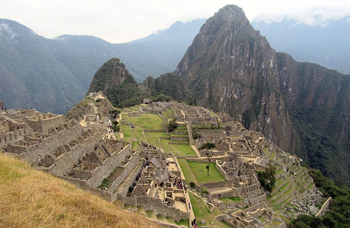
Its name in Quechua means “Old Peak”.
Machu Picchu sits on a ridge between Machu Picchu mountain and Huayna Picchu (“Young Peak”), 112.5 km from Cusco along the railway line from Cusco to Quillabamba.
The city lies at 2,000 m (6,560 ft) above sea level, and its central part, the Temple of the Sun, is at 2,350 m (7,710 ft). The summit of Machu Picchu mountain reaches 3,050 m (10,000 ft).
It is not known whether its original name was Machu Picchu. There are records showing that other people had visited the site before Hiram Bingham’s discovery. In 1902 Agustín Lizárraga reached the site and left a graffiti inscription as evidence, which Bingham later had erased. Machu Picchu was first considered a citadel, but various pieces of evidence show that it was a ceremonial center.
It is estimated that the site could only house between 300 and 1,000 people. The city was built during the last stage of the Inca culture, probably during the reign of Pachacutec, in a single continuous phase of construction. Machu Picchu is the greatest architectural achievement of the Incas and a symbol of Peru around the world. The city was always known to local people, but it was only on July 24, 1911 that it was made known to the world by Hiram Bingham, an American explorer and professor at Yale University. He was guided to the site by a local farmer, Melchor Arteaga.
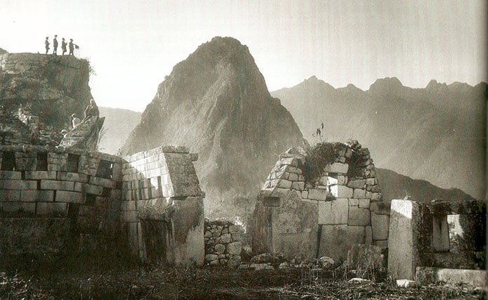
The citadel is made up of two sectors:
1) The Agricultural Sector
This is the area of the terraces, or andenes, which would have been used for farming. The retaining walls of the terraces are on average 4 meters high. All the terraces face the sunrise.
Highlights of this sector are the colcas, or storehouses, and the Guardhouse (Casa del Vigía), a building with three walls and one open side. It overlooks both the agricultural and urban sectors, and it is the spot from which the classic photos with Huayna Picchu in the background are taken.
2) The Urban Sector
This is the residential area, with streets and stairways. The buildings are mostly rectangular and single-story, with trapezoidal doorways and windows. The area is characterized by streets, stairways, small squares and halls, and a system of channels that supplied water to the inhabitants.
The city is surrounded by cliffs and walls that gave it good protection against enemy threats.
The main sites include:
TEMPLE OF THE SUN (the Tower), or ROYAL TOMB, stands out for its semicircular construction with three windows facing north, east and south. The tower was built on a rock formation with a cave underneath. It is thought that the Incas designed it to symbolize the three levels of the world: the Hurin Pacha, the world of the dead or the ancestors, represented by the darkness of the cave; the Kay Pacha, the world of the living, on which the building stands; and the Hanan Pacha, the celestial world, symbolized by the sunlight entering through the east window of the tower.
THE ROYAL PALACE is made up of four rooms arranged around a courtyard. Evidence has been found that one of the rooms was used as a bathroom.
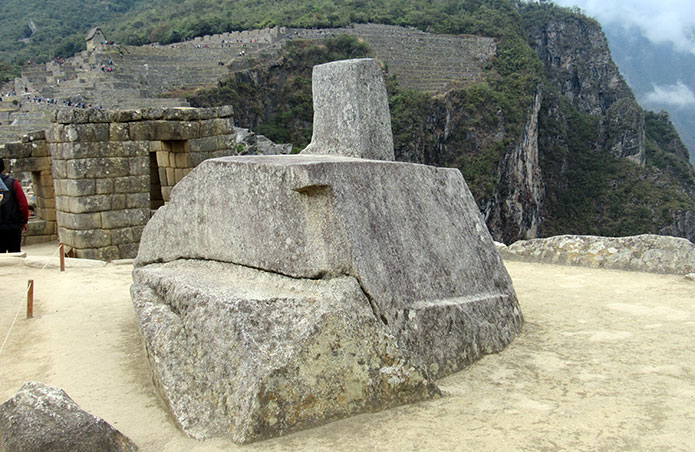
THE INTIHUATANA, “the place where the Sun is tied”, is located in the highest part of the urban sector. It was carved from a single block of granite. Its main part is a prism whose four sides face the four cardinal points. This site had special importance. It is thought to have been used for astronomical purposes related to measuring time, according to the shadows it cast when lit by the sun, which is why it is also called a “sundial”. Other researchers believe the stone was carved to represent Huayna Picchu.
THE SACRED ROCK is located before the entrance to Huayna Picchu, facing a small square. The upper outline of the rock imitates the shape of Mount Yanantin, which rises east of Machu Picchu on the other side of the Urubamba River.
THE TEMPLE OF THE CONDOR takes its name from a rock formation carved to represent a condor, with its head, beak and collar.
Advertisement


